Orienteering across Fuerteventura’s dunes
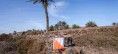
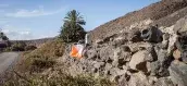
Almost directly from Costa Calma Beach, in the municipality of Pájara (Jandía Peninsula, southern Fuerteventura), visitors can begin an orienteering route that challenges them to run across dunes and sandy terrain, navigate through the area’s characteristic low vegetation and even discover small pine groves along the way. The effort is rewarded with the chance to enjoy Costa Calma Beach, renowned for its spectacular golden sand and excellent facilities.
A unique map in Fuerteventura
This is a varied, fun, demanding and highly unusual map. Sandy terrain, low vegetation and diverse elevation changes create a challenging orienteering experience. Accurate map reading and contour navigation skills are essential. The best part is that, once the challenge is completed, a beautiful beach awaits within the same area. The experience can be complemented by visiting the distinctive villages nearby or enjoying the extensive leisure opportunities available in the tourist resort of Pájara.